Thursday 4th, October at 3:30pm in Washington 315

Throughout the eighteenth century, trees stood at the intersection of numerous and often competing discourses of value. Across Europe and North America, they were viewed both as precious commodities and as ‘the true monuments of nations’, as Bernardin de Saint-Pierre noted in 1784,underscoring the imposing and inescapable materiality of these plants, their cultural significance, and their political value in the project of modern nation-building.
Trees could also be appreciated as charismatic objects of personal desire and of intellectual fascination, just as they were at the heart of Enlightenment discussions on environmental management and sustainability.
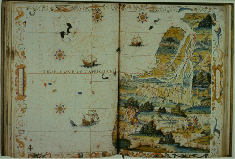
 From the 1530s on, the city of Dieppe in Normandy became an important center of cartography and later on of hydrography. Dieppe was at the time one of the most important port for French international expeditions: the city sent commercial ships to Newfoundland, Brazil, the West African coast and as far east as Indonesia. The Dieppe maps of the mid-sixteenth century generally took the form of world atlases or of large world maps, all richly illustrated with lavish miniatures. These maps were hand drawn and painted; their large scales made them useless for navigational purposes. In this talk I propose to explore what we know about a set of Dieppe maps from the 1540s and 1550s: why were they created? What do we know about their circulation? Where did the possible models for their illustrations come from? I will in particular explore the possible connections between the advent to the throne of Henri II in 1547 and the apparent increased production of such maps in the latter half of the 1540s.